
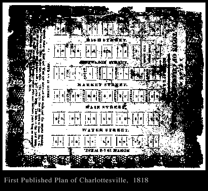
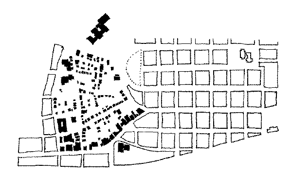
Charlottesville was established by an Act of the Virginia Assembly in 1762 as a gridded courthouse town, serving the newly defined Albemarle County. Twenty eight one acre blocks (200 feet square) were laid out along a pre-existing east/west thoroughfare called the Three Notch'd Road. This route connected Richmond and the tidewater region with a gap in the Blue Ridge mountains, thus providing access to the Shenandoah Valley. This early and important transportation link is now paralleled by State Route 250 and Interstate 64. In the immediate vicinity of contemporary Charlottesville, Three Notch'd Road corresponds with Main Street between downtown and the University to the west, and Market Street as it leads toward the Rivanna River and the Woolen Mills neighborhood to the east. The original twenty-eight block grid falls within the following existing streets: Sixth and McIntire on the east and west respectively, Jefferson and South on the north and south. A plan from 1818 indicates east/west streets as 66 feet in width, while north/south streets as 33 feet wide; this plan also indicates a two block by seven block annexation added directly to the north of the original grid.
A two acre public square was set aside for the courthouse on a hillside directly above the gridded village, several blocks to the north of Three Notch'd Road or the main street of town. Early business activities around the Court Square included taverns, tailors, milliners, a printing shop, a gunsmith, and a jeweler. A portion of the original courthouse (1803) still stands as a part of the current complex of structures. In the absence of church structures throughout the early period of the town's history, the sole point of civic focus was the courthouse and its enclosing square of shops and taverns, with an emerging mercantile area slowly appearing along Main Street several blocks below the courthouse.
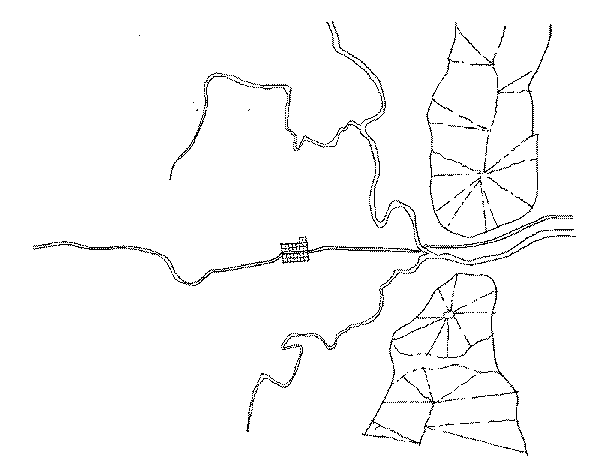
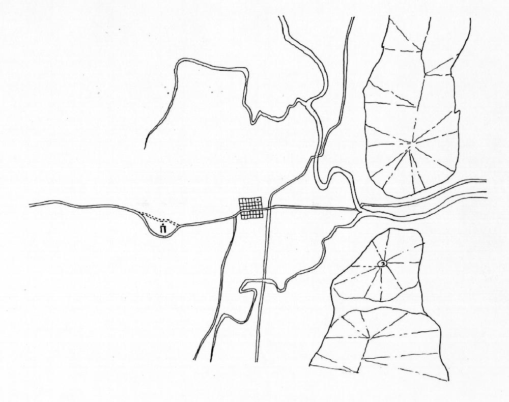
The geographic and topographic conditions of a town profoundly influence its subsequent development. At the regional scale, Charlottesville's separation from a navigable river complicated communication and trade, limiting its development before the arrival of railroads in the mid-nineteenth century. At the more detailed scale of the town's plan, Charlottesville's urban growth encountered and accommodated a series of influential factors including ridge lines, ravines, small hills, water sources, etc. The hilly terrain in particular led to the development of several independent and nearly disconnected neighborhoods within close proximity to the downtown area.
Several distinct residential settlements emerged both within the original city grid and around its periphery. Park Street to the north and Ridge Street to the south included houses of prominent merchants and businessmen from the city. The westernmost section of downtown called Vinegar Hill and later Random Row, emerged as a business and residential center largely occupied by portions of the town's black population (see further discussion of Vinegar Hill under separate heading.) Other significant nineteenth century neighborhoods close to the downtown area or Main Street and included in this urban design study are Belmont, Star Hill, and Fifeville.
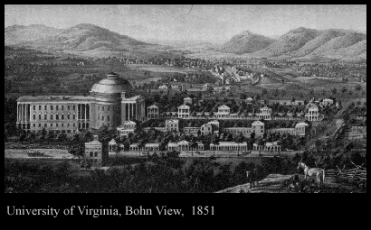
The University of Virginia was founded in 1819. As the institution's founder and principal visionary, Thomas Jefferson selected the site atop a small hill one mile from the center of town. The placement of the university away from the city established the "Academical Village" as distinct from the activities of town life. Jefferson's suspicions about the city and his clear preference for an agrarian basis of society in the newly formed republic are well documented, and it clearly influenced his attitude toward the founding of a non-sectarian and state supported institution of higher education. The University's location "outside of town" profoundly affected the subsequent urban development of Charlottesville by providing a strong westward focus of development, particularly along Three Notch'd Road (Main Street) connecting the University to the west and the town's center to the east. A small commercial area called The Corner developed adjacent to the University, supporting the student and faculty population as the institution grew.
| Charlottesville Railroads | Charlottesville Late 19th and Early 20th Century | Charlottesville Post World War II | Charlottesville Brief Notes |
 Charlottesville Archive
| Bibliography | Make a suggestion |
 IATH WWW
Server
IATH WWW
Server
 Return to beginning
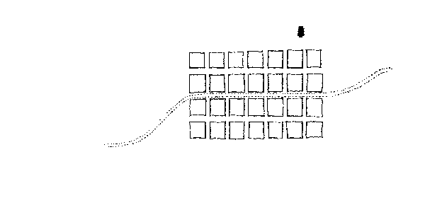